Upper Harz
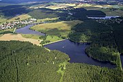
The Upper Harz is the northwestern and higher part of the Harz mountain range in Germany. The exact boundaries of this geographical region may be defined differently depending on the context. In its traditional sense, the term Upper Harz covers the area of the seven historical mining towns (Bergstädte) - Clausthal, Zellerfeld, Andreasberg, Altenau, Lautenthal, Wildemann and Grund - in the present-day German federal state of Lower Saxony. Orographically, it comprises the Harz catchment areas of the Söse, Innerste and Grane, Oker and Abzucht mountain streams, all part of the larger Weser watershed.
Read article
Top Questions
AI generatedMore questions
Nearby Places

Clausthal-Zellerfeld
Place in Lower Saxony, Germany
Oberharz (Samtgemeinde)
Samtgemeinde in Lower Saxony, Germany

Clausthal University of Technology
German university

Upper Harz Mining Museum

Polsterberg Pumphouse

Upper Harz Water Regale
UNESCO World Heritage Site in Lower Saxony, Germany

Jägersbleeker Teich

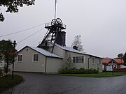
Emperor William Shaft
Mine in Clausthal-Zellerfeld

